← The Thomas and Bridges Story, 1540–1840
Chapter II: James Thomas leaves North Carolina for Kentucky
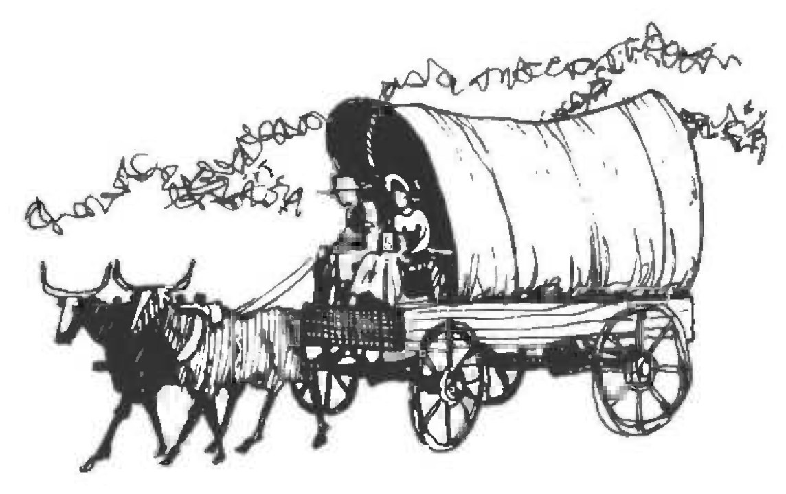
The big question, after one wonders why James Thomas migrated to Kentucky, is which way did he travel from Bertie County, North Carolina, nearly 650 miles across a vast forested wilderness to Donaldson Creek in Christian County, Kentucky?
West was the general direction. Today the journey would be simple enough with a road map and an automobile. In 1806, James Thomas probably followed the crowd. By the time he was ready to leave North Carolina for Kentucky, the trail across the state had become well defined. Fact was, the trail was quite distinct all the way to Fort Nashboro, site of present day Nashville, on the Cumberland River in the middle of Tennessee. But despite the many settlers who had preceded them, the trail still was not an easy one.
James and Mary Thomas with their six children—Cullen, 15; Temperance, 13; Perry 9; Starkie 7; Mary 4, and James 2 (Mary was expecting her seventh child in the fall)—left their plantation on the Cashie River, certainly after the March rains were over, most likely in the latter part of April 1806. With them were several of their neighbors including some of the Barnes and Sholar families, all of whom formed a wagon train that moved slowly along the trail near the Cashie River to Windsor. From there the train wound into Edgecombe County where, at Tarboro, the settlers crossed the Tar River by ferry and continued westward across the state.1
Within a week, they were part of a much larger wagon train, many elements of which had come from the south near Elm City in Edgecombe, now Wilson County. They lumbered slowly along the dusty trail, at best, some 15 miles per day.
Today this trail site is roughly paralleled by U. S. highway 64 and state route 98 from Tarboro to Durham; U. S. Highway 70 to Greensboro; U. S. Highway 421 via Winston-Salem to Boone, then U. S. Highway 321 to Elizabethton, Tenn. More recent interstate highways also parallel the area.
In 1806 the trip from North Carolina to Kentucky by oxen-drawn wagons required at least three months depending upon the number of stops along the way. The trip across North Carolina was comparatively easy. From Bertie County, lying on the coastal plain near Albemarle Sound only a few feet above sea level, the trail led gently upward across the center of the Piedmont plateau. At the western edge of the Piedmont lay the Appalachian Mountains. Formidable obstacle to the trail was that part of the range known as Stone Mountains. It was a good days journey to the summit of this range, now part of the boundary between Tennessee and North Carolina. Usually the emigrants camped at the foot of the mountains and got a fresh start up the steep trail early the next morning.2
The trail was not exceedingly difficult to ascend, but when the wagons reached the base of the ridge they were met by a huge rocky escarpment that towered hundreds of feet above them making it look a bit more terrifying than it actually was. The trip down the mountain on the western slope was more difficult. On many occasions, heavy logs were tied to the rear of the wagons to prevent them from moving forward too fast or rolling out of control into the plodding oxen.3
When James Thomas reached Fort Patrick Henry, near what is now Kingsport, Tenn., he was faced with a choice of two routes, either of which would likely be difficult. One was to travel down the Holston River on a flatboat. Even before 1780 pioneers were floating down the Holston into Tennessee en route on their long journey to what was to become known as the Cumberland settlements, now Nashville. This worked especially well in the spring, although John Donelson had left Fort Patrick Henry in December 1779 for Fort Nashboro, traveling all the way down the Tennessee River to its confluence with the Ohio near what is now Paducah, then up the Ohio to the Cumberland then up that stream to the site of present day Nashville,4 a journey of over 800 miles and one that required more than four months to make.
The other choice for James Thomas was to continue his overland journey, one that led down the valley toward Knoxville over a well established trail on the west side of the Holston River.
During the dry summer months when the Holston was short on water, many emigrants took that still perilous overland route that led from Elizabethton via Rogersville to Kingston, Tenn., west of Knoxville. This trail was extremely dangerous as late as 1784. Lone riders hired to carry letters from Elizabethton and Watauga via Kingston to Fort Nashboro, charged as much as $50 to make the trip,5 a sum “dearly earned in many cases,” it was said. By 1806 however, the danger was minimal, especially from Indian attack. By that year too, the renowned Cumberland Gap route was seldom used as an entry for emigrants headed for Kentucky. The Gap continued to be used as a thoroughfare by those traveling to and from the state, but most choice lands of Kentucky’s famed Bluegrass region had been claimed by the late 1700’s so settlers continued farther west. In addition, for those heading for the extreme western part of Kentucky, the Gap route would have added many miles to their journey.
Actually it is not known for sure whether James Thomas rode down the Holston by flatboat or continued by land. It is generally believed however that he chose the flatboat because April was the ideal time for such a venture, and James Thomas was not one to let a good opportunity pass without attempting to take advantage of it. Spring rains and melting snows from high in the Appalachians usually kept the Holston and its tributaries well supplied with water sufficient for the floating of flatboats until early summer.
Assuming that the Holston route was James’ choice, his need was a flatboat. Fact was, he needed two for he intended to take his entire worldly possessions aboard. These possessions consisted of two wagons loaded with household goods, two yoke of oxen, one milk cow, probably two horses, most certainly a dog, a couple of cats, several chickens, maybe a hog or two — and of course — his wife, six children and likely one or two Negro slaves.
Except for stops at night when they landed and made camp, and a few daytime stops in order to replenish the food supply by shooting wild game, the trip was probably rather uneventful. The Holston and French Broad rivers join near Knoxville to form the Tennessee River, but that was just another overnight stop for those settlers making the river journey. They floated some additional 50 miles to Kingston at the confluence with the Clinch River. There the emigrants debarked and disposed of their flatboats. Settlers who had sold their oxen and wagons before leaving on their trip down the Holston, had to trade for more at Kingston before heading west across the Tennessee highlands. This was one problem that James Thomas didn’t have to face.
Kingston, Tenn., was located at the end of a long, grassy valley. Across the river from the settlement was Southwest Point, a military garrison so stationed to protect settlers heading west over the Walton Road.6
The Walton Road was authorized by the Tennessee Legislature in 1799 and a sum “not to exceed $1,000” was appropriated for its construction.7 It was completed in 1801 by Captain William Walton from whom it got its name. He settled on a Revolutionary War grant of land at Carthage, Tenn., the road’s northwestern terminus,8 a site later to become the seat of Smith County.
Continuing west, James Thomas with his two wagons and family, joined a caravan of other wagons that had formed a train at Kingston and headed into Tennessee along the Walton Road. Leaving the lowlands of the river, the road skirted around a long rocky portion of the Appalachian chain known as Walden’s Ridge. Beyond that, the trail led over Spencer’s Hill to Crab Orchard, site of a camping ground used by practically all settlers traveling the Walton Road.
When James Thomas and his family arrived there to spend the night in the spring of 1806, the new Crab Orchard tavern was about four years old. The travelers camped outside, but the menfolk of the families usually gathered at the tavern for an evening of relaxation and talk before bedding down for the night. The tavern became a well-known stopping place and visitors included President Andrew Jackson during his tenure as president of the United States, on his trips between Washington and his home at the Hermitage near Nashville. The old inn stood until 1925.9
The Walton Road continued west through Crossville, so named later because it crossed another of the early day routes at that point. Today it is the county seat of Cumberland County. From there the road led to Standing Rock (now Monterey) named for a large, conspicious outcropping of stone, a landmark visible to travelers for many miles. The road passed through Cookeville, a point almost in the heart of the Cumberland Plateau, a tableland nearly as level as a western prairie. At that time however, it was heavily wooded with vast forests of virgin timber.
From Cookeville it was downhill most of the way to the Cumberland River. The road veered slightly north in order to avoid having to cross the rather sizable Caney Fork River that emptied into the Cumberland just upstream from the settlement at Carthage. There, emigrants bound for the areas north of Nashville, both in Tennessee and Kentucky, were ferried across the Cumberland to continue their journey overland. Settlers headed for Fort Nashboro, usually crossed the Caney Fork River and continued along the road south of the Cumberland via Lebanon in Wilson County. Some settlers obtained flatboats either at Carthage or Fort Nashboro, and floated down the Cumberland to their property. One Kentucky-bound family, the Futrells of Northampton County, North Carolina, came down the Cumberland by flatboat but missed the mouth of Donaldson Creek and landed at Boyd’s Landing, now Canton, instead.10
In Smith County, Tenn., James and Mary Thomas very likely stopped to visit with James’ sister Sarah, who lived on Goose Creek in that county with her husband, Andrew Greer, and their family. They had moved to Smith County from the Watauga Valley near Elizabethton, Tenn., and spent the remainder of their lives there.11
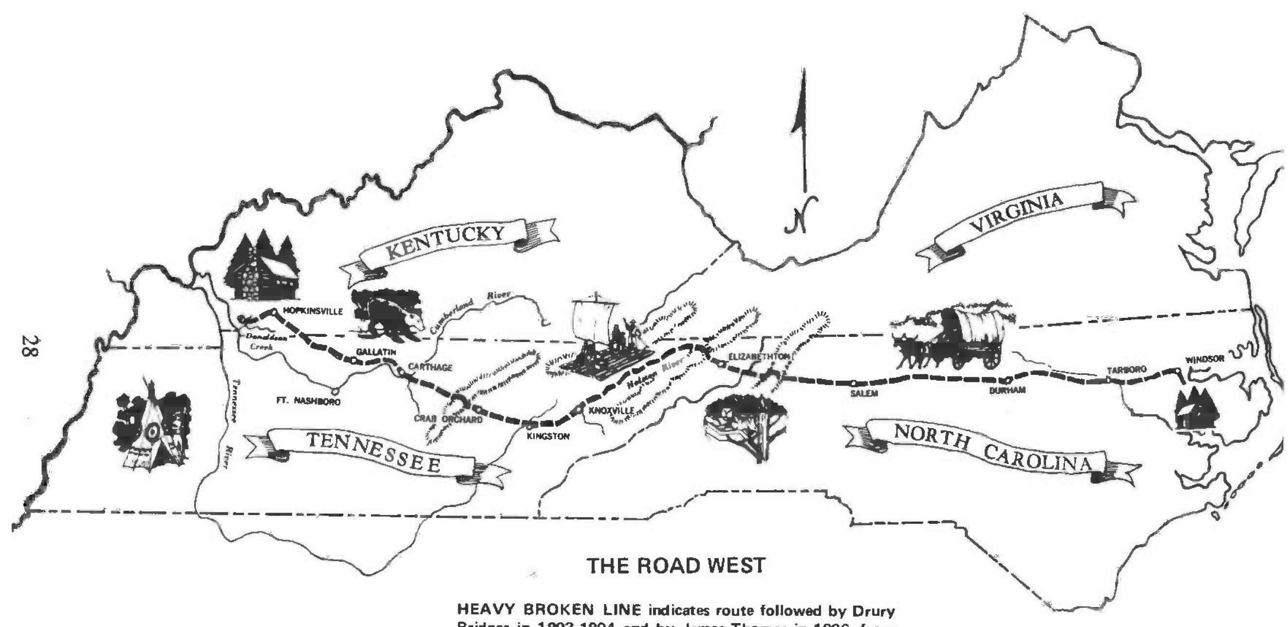
After a visit of several days during which time the family rested from the ordeal of their travels, James Thomas and his family resumed their journey. From Smith County the comparatively easy trail led via Gallatin and Springfield, Tenn., to Hopkinsville, in Christian County, Kentucky. After resting there, probably overnight, James and family left on the final lap of his long trek — the remaining 20 miles to Donaldson Creek, his new home.
The secluded valley in which James Thomas II settled, begins at the extreme western edge of an area of Kentucky known as the Barrens some eight miles north of the Kentucky-Tennessee state line, and about 7 1 /2 miles east of the Cumberland River. It lies between wooded hills that range up to 700 feet above sea level, and runs almost due west. Physically, the valley has an almost level floor, which at the head is about 460 feet above sea level, and in its westward course, drops to about 350 feet at the point where the creek empties into the eastern bank of the Cumberland River. It varies in width from about a quarter of a mile at the beginning to almost a mile near the river. Several deep valleys ranging from two to five miles in length branch from the main valley.
The first residents in the Donaldson Creek valley entered by a trail that led from the Barrens at a point a few miles from what is now the line that divides Christian and Trigg Counties, down a winding half-mile long hill to the valley floor. The sight they saw must have been one of welcome relief, for, as one account put it, there were no trees, shrubbery, or undergrowth of any kind across the Barrens between Donaldson Creek and Hopkinsville big enough from which to “obtain a riding switch.” Believing that the Barrens would never be worth anything because the land would not grow trees, early settlers sought the more secluded areas along the Donaldson Creek valley where there were springs, a perpetual stream teeming with fish, and forests full of wild game and towering trees suitable for building cabins and other structures so necessary for the pursuit and protection of life in the wilderness. As it turned out however, much of the Barrens in Christian County ultimately was converted into some of the best farmland in Kentucky outside of the Bluegrass.
The long, picturesque Donaldson Creek valley was quickly settled by hardy emigrants mainly from North Carolina. They lost little time in clearing the fertile creek bottom land for cultivation. The rich alluvial soil was soon put to work growing crops of tobacco and corn plus a wide variety of vegetables, seeds for which had been brought all the way from North Carolina. Later, the enterprising residents set out fruit trees12 — apple, peach, plum and pear — in an effort to provide cultivated fruit to add to the abundant supply of wild plums, haws, pawpaws, numerous wild berries and nuts that grew in profusion in the valley.
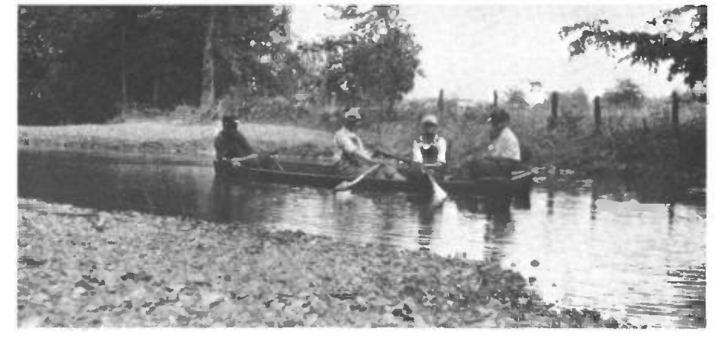
Meandering rather haphazardly down the valley; principally along the foot of the southern range of hills was Donaldson Creek, the main body of which was formed by two smaller streams that originated in two rapidly descending valleys shaped like a broad letter V. They joined near the base of the range of hills down which the settlers entered the valley. Waters of the stream rippled over scattered gravel shoals the year round, flowed through deeper pools past numerous out-croppings of limestone by ever broadening fields filled with lush growing crops; in the warmth of each ensuing summer, sons of the settlers splashed and swam in the creek’s cooling depths. The stream’s tortuous course covered over 10 miles, more than two miles greater than the length of the valley as the crow flies, before it emptied into the normally placid waters of the Cumberland River.
Generously spaced at intervals along the foot of the hills that enclose the verdantly green valley were numerous springs from which daily flow hundreds of gallons of fresh, cool, limestone-laden water. It was near these springs that many of the early settlers built their cabins.
The valley floor in the early 1800’s was covered with enormous trees of oak, beech, poplar, walnut, ash and other valuable hard and soft woods. The early settlers soon cleared large areas of timber to make way for their farmland. The logs were cut to appropriate lengths, hewn, notched and used to build houses, barns, livestock pens and numerous other structures necessary for protection and the pursuit of life in the new state of Kentucky. Other logs were split into rails with which to build fences, and the remainder was used for fuel to warm the homes in winter.
The forest covered hills on each side of the valley provided a haven for wild game, and when additional food was needed, men of the family went forth armed with muzzle loader, powder horn and flint. They usually returned with wild turkey, grouse, quail, dove, squirrel, rabbit or deer. In addition, the creek teemed with fish — bass, trout, red and black perch and other varieties for the taking — and as far as James Thomas was concerned, this was the western paradise he had envisioned before he left North Carolina, the kind of country for which he had fought in the Revolution. Here he would stay.
Principal tributary of Donaldson Creek was its “Beechy Fork Branch” as it was listed in a number of the land grants. This stream had its beginning in the range of hills about a mile and a half north of the original James Thomas land grant, and it ran west through a narrow, five mile long valley then it veered almost due south for another mile or so to a confluence with the main stream of Donaldson Creek. The valley though smaller than Donaldson was equally as blessed with springs, luxurant growths of timber and fertile land.
As time passed, other settlers learned of the rich area along Donaldson Creek and its tributaries and came in increasing numbers with each family being able to locate comfortably at various points along its forested length. They cleared more “new ground” and extended their farms ever westward. In time settlers cleared land beyond the mouth of Beechy Fork Creek, and eventually hacked their way through the enormous cane brakes all the way to the Cumberland River. In time too, they would clear land up into the hills and some even staked out claims on the thin-soiled, less productive high ridges both to the north and to the south.
One of the early projects in the valley was to build roads in order to connect the homesites. First, a thoroughfare still referred to as “The Big Road,” was laid out along the entire length of the valley,13 chiefly along the foot of the northern range of hills. Paths and lanes were cut along property lines between farms to provide access for those who had built their homes and cleared ground across the creek on the south side of the valley.
Early in the life of the community, a branch road was built over the northern range of hills some three miles west of James Thomas’ place leading to what later was to become Maple Grove. After Trigg County was formed in 1820, this road was extended west along the north side of Beechy Fork Creek, and eventually north to Cadiz. Additional roads were built — to Olive’s Landing, later to be called Linton, a corruption of “Linetown,” so called because it was near the state line; to Boyd’s Landing, later called Canton14 and to Dover, seat of Stewart County, Tennessee. All three points were located on the Cumberland River. The Dover Road was an extension of the Cadiz Road, and led to that settlement by the way of Skinner’s Ferry, later called Tobaccoport.
James Thomas and his wife Mary — he called her Mollie — and their six children began a new life in a one-room log cabin that he and his son Cullen, with the help of neighbors, had built of white oak logs near the intersection of what is now the Donaldson15 and Cadiz roads. Their youngest child, Stanley, was born November 16, 1806 after they had arrived in Kentucky in July.
Very little is known about James Thomas II, his temperment, his disposition, or his physical features. But William Henry Perrin, in 1884, had this to say about him:
“. . .Living through the storm of the Revolution, he inherited that patriotic devotion to his country so peculiar in those days, and gave as a reason for not moving west earlier than he did, that he recognized the same obligations to the State of North Carolina until he was 45 years of age that he did to his parents until he was 21. Taking leave of the country then, soon after his second maturity, he turned his face to the great West and after a long and tedious journey, arrived on Donaldson Creek. . .Not possessed of the restless disposition of most men, when they have once torn away from the place of their birth, he felt perfectly satisfied in his new home and resolved at once to spend the residue of his life there. He never broke that resolution. . .(He) was a man of good morals. . .a consistent member of the Baptist church. . .a good farmer, an excellent citizen and full of the milk of human kindness.”16
By 1820 when Trigg County was formed, the population totaled 3,874 according to the U.S. Census taken that year. By that year too, three of James and Mary’s children had married: Cullen in 1812, Temperance in 1813, and Mary in 1820. Perry married the following year, and Starkie in 1825. Interestingly enough, Mary, Starkie and Perry each married a member of the Drury Bridges family who had migrated to the valley in 1804 from Edgecombe County, N. C. The seven children of James and Mary Thomas married and produced a total of 54 children. These 54 children married and had 226 children. They in turn had over 900 children. By the fifth generation, James and Mary Thomas had nearly 4,000 descendants.
Descendants Of these seven children in the past 164 years have married into practically every family in Trigg County, but the largest number has descended from the marriage of Mary, Starkie and Perry into the Bridges family. By the time various intermarriages took place in the ensuing generations, there were dozens of double cousins on both sides of the family. Many members of the family, tracing their lineage today, often find James and Mary (Standley) Thomas as their ancestors on both sides.
The Thomas family has always been, and still is blessed with many talents. Its members are independent, thrifty, fun loving, full of laughter, practical jokes, and often are hot headed and obstinate. They don’t mind hard work, but they also love leisure and many have been known to pursue it to the extreme. They are musicans, mechanics, carpenters, painters, politicians, singers, writers, artists, teachers, doctors, pharmacists, ministers, deacons, cabinet makers, salesmen, and—as has been their lot since the first Thomas arrived in Virginia in the early 1600’s — they have been, and still are good tillers of the soil. They brought with them to Kentucky the ability to sustain themselves in a wilderness, relying on little but the available resources. They also brought from North Carolina the art of tobacco growing, a crop that today is still a chief source of income. The Thomases were also industrious in many other ways. They set up grist mills, saw mills, tanneries, distilleries and other enterprises to help make themselves more self reliant.17 That proud, independent feeling of self reliance has been kept alive down through the years and is still apparent today.
During the nearly one-and-three-quarter centuries since the James Thomas family first came to Kentucky, his descendants have been interested and involved in the welfare of their community, county and state. After Trigg was carved out of Christian in 1820, the Thomases were among those who helped the fledgling county to stand on its own feet. First poll books in the new county include names of James Thomas and those of his sons.18 Later lists included the names of their sons as well.
First county officers elected (by state law enacted in 1850) included Stanley Thomas, youngest son of James and Mary, who won the race for sheriff over four opponents. Luke Thomas, nephew of James, served on the third grand jury to be empaneled in the new county. His brother, Ezekiel, (both had come from Bertie County prior to 1812) served on the grand jury of November 1820 term of circuit court along with Zadock Thomas, a distant relative also from Bertie County, N. C., who had migrated to Trigg County in 1807 and who had settled on Muddy Fork Creek.19
Stanley Thomas was elected to represent the county in the state legislature in 1840 prior to his tenure as sheriff. Cullen Thomas served as surveyor and magistrate prior to 1830, and as sheriff in 1840. Starkie served as constable at various times, Perry as tax assessor, and James III was justice of the peace for several years.20 A number of other descendants of the Thomas family have also held various elective offices in the county and state down through the years to the present.
North Carolina map, published with the 1790 census.↩︎
“The Rear Guard of the Revolution,” by James R. Gilmore, 1886, page 53.↩︎
Handwritten notes on the Futrell Family, by Charles Ross, from collection of Mrs. Os Page.↩︎
“Donelson’s Journal,” (Three Pioneer Tennessee Documents) Tennessee Historical Commission, Nashville, Tenn, 1964.↩︎
“Chattanooga Country,” by Govan and Livingood, revised edition, University of North Carolina Press, 1963, page 37.↩︎
“TENNESSEE, A Guide to the State,” Viking Press, 1939, page 437.↩︎
“Sectionalism and Internal Improvements in Tennessee,” by John Folmsbee, page 25.↩︎
Tennessee highway historical marker on U. S. highway 70 west of Cookeville.↩︎
Pamphlet: History of Tennessee Central Railway, 1903. L&N Archives.↩︎
See reference 3.↩︎
“Tennessee Cousins,” by Worth S. Ray.↩︎
Filson Club Quarterly, April 1967, page 170.↩︎
Trigg County, Ky., Order Book A, page 18.↩︎
“History of Trigg County,” by William Henry Perrin, 1884, pages 112-117.↩︎
Most early records indicate the spelling as “Donelson.” Today and for many years past, it is spelled Donaldson. I have found nothing to indicate for whom the creek was named, but likely it was for John Donelson, who, in 1780, traveled up the Cumberland River and may have camped at the mouth of the creek where it empties into that stream.↩︎
Perrin, page 109.↩︎
Ibid page 40.↩︎
Trigg County poll books, Nos. 18, 26, 27, 29, 41, 42, 50 et al.↩︎
Neel, page 248. Zadock Thomas married Dicea Bazemore, Jan. 12, 1793 in Bertie County, N. C. On Oct. 19, 1809, after having migrated to Christian County, Ky., (now Trigg) they sold 150 acres of land lying on the Cashie Swamp in Bertie County, N. C., to Turner Bazemore, Dicea’s brother, for $ 1 , 2 0 0 (Bertie Deed Book V, page 291.) Dicea (Bazemore) Thomas apparently died in Christian County prior to 1815, as on Oct. 26, 1815, Zadock Thomas married Mrs. Sally (Rucker) (Tanner) Rutter, Caldwell Co., Ky. Children by his first wife were: Ranson; Fanny, married Dunning Kennedy, Trigg County June 24, 1824; William; Louisa, married Robert Wiley Rhodes Jan. 2, 1817. Zadock Thomas had a daughter, Malinda by his second wife. She married (1) Reuben Harris, Caldwell County, Oct. 31, 1832; (2) William H. Boyd, Trigg County, Aug. 16, 1853. Zadock Thomas died in Caldwell County April 1829 and his will was probated Oct. 20, 1829. (Will Book A, page 425.)
NOTE — Part of this information supplied by Mrs. Beverly Dockery, Madisonville, Ky.↩︎
Trigg County Order Book A; Perrin, pages 32, 33, 219.↩︎